Every bridge provides a distinctive visual experience that is amplified by the unobstructed view from a motorcycle. And, throughout the US, there are ferries which have unique characteristics and others that take you back in time. Hence, the plan for this tour was to seek out several of the ferries and significant bridges on the East Coast along with a visit, for the first time, to Cape Hatteras National Seashore.
This trip, however, can be summed up by the numbers: 5 days, 6 states, over 1100 miles, 4 ferries, 1 bridge-tunnel, and 6 other noteworthy bridges.
Day 1 - New Jersey & the DelMarVa Peninsula
We left early on a cold morning and used the superslab to get to the first item on our agenda, the
Commodore Barry Bridge. The fourth longest cantilever bridge in the world, and the longest in the United States, it crosses the Delaware River between Chester, PA and Bridgeport, NJ and provides a wonderful view of the ships navigating to and from the Port of Philadelphia.
From there we stopped at Mullica Hill for breakfast and then picked up NJ 55 south. 55 is a very nice 4-lane limited access highway with light traffic. It merges with NJ 47, which is a favorite route to reach the southern New Jersey shore.
NJ 47 brought us close to our first ferry of the tour, the
Cape May-Lewes Ferry. It provides an enjoyable 1.5 hour cruise across the Delaware Bay. Our ship, the Cape Henlopen, had a sun deck, comfortable lounge area, refreshments, and a gift shop. Being off season, there was no problem getting on board, but during the summer tourist season, reservations are recommended.
Once in Delaware, we headed south on DE 24 which is a straight shot (with several route designation changes) to Pittsville, MD. There we met my college roommate and his wife for lunch and socializing at the
Station 7 Restaurant.
After a 2 hour visit it was back on the road. Just east of Pittsville, I picked up MD 354/364 to Pocomoke City. It turned out to be an excellent road: smooth tarmac, light traffic, with well kept farms and Milburn Landing State Park providing nice scenery. A gem of a road for this area in my opinion.
Pocomoke City was our final destination for the day, but before we checked into our motel, we stopped by Cypress Park to stretch our legs and admire the sailboats docked along the Pocomoke River. A fitting conclusion to a diverse day of adventure and riding.
View Larger Map
Day 2 - On to Cape Hatteras
From Pocomoke City the main route south is US 13, a 4-lane highway with moderate traffic and a significant amount of 18 wheelers. Add flat terrain and you have a lackluster ride. With this in mind I left US 13 at Temperenceville, VA on Saxis Road then headed south on VA 693 to Greenbush. 693, which changes route designations several times, was a very straight road that paralleled a railroad and passed through some small villages. However it still was a good substitute for US 13. From Greenbush I crossed over US 13 to Accomac with the intent of using VA 605 and 600. 605 was a nice road but VA 600's road surface was a 'washboard' so I got back on 13.
US 13 takes you to the
Cheasapeake Bay Bridge-Tunnel. This structure, which is an engineering marvel, "consists of a series of low-level trestles interrupted by two one-mile-long tunnels beneath Thimble Shoals and Chesapeake navigation channels." Although we have crossed this bridge tunnel several times, it always provides an unmatched milestone.
After traversing through the Norfolk/Virginia Beach metro area, it was a nice ride on VA/NC 168 and US 158 to the Outer Banks area. Here you cross Currituck Sound on the Wright Memorial Bridge which is almost 16,000 feet in length. Once we got through the traffic and lights of Kitty Hawk and Nags Head, we stopped at the
Sugar Creek Seafood Restaurant for lunch. The food was excellent and our table had a great view of Roanoke Sound.
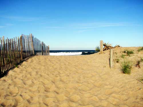
From there it was south on NC 12 through the Cape Hatteras National Seashore. Undeveloped for the most part and remote, Cape Hatteras gives you a glimpse of the Atlantic Ocean shoreline in all it's pristine glory.
Just south of Nags Head you reach the
Herbert C. Bonner Bridge which spans Oregon Inlet. It is scheduled to be replaced within the next few years.
Being off-season, the beaches were deserted except for kiteboarders displaying their skills on Pamlico Sound. It was a wonderful visual experience with the dunes on the left and the kiteboarders to the right. With little traffic it was 'smooth sailing' though these barrier islands. You only had to slow down while going through some small villages which service tourists. Not one traffic light along the way.
After another good day of riding we reached our destination, Buxton, and checked into the
Cape Hatteras Bed and Breakfast. After settling in, we took a walk up to the beach to watch the surf. Here is the view as we approached the beach.
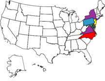
Our route for the day.
View Larger Map
Day 3 - More ferries and the Albemarle-Pamlico Peninsula
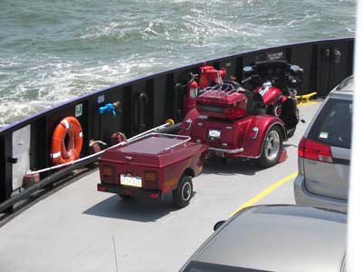
At the B&B we had an enjoyable breakfast provided by our hosts, Jed and Virginia. Virginia even baked a loaf of bread to accommodate by food allergy. After breakfast we were on the road and, after a short ride, reached the Cape Hatteras-Ocracoke Ferry. It is a free 40 minute cruise between the two islands. The ferry is relatively small (30 car capacity) but it runs every 30 minutes during May.
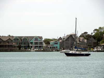
Another short ride through Ocracoke Island brought us to the village of Ocracoke. We had some time to wait for the next ferry, so we had a snack at a picnic table right on Pamlico Sound then walked to the Visitor's Center. Ocracoke is a quaint little town. Wish we had more time to explore it.
By the time we got on our ferry, the Cedar Island, it was already 1pm and we had a 2.5 hour cruise to get to Swan Quarter, NC with a substantial ride after that to reach our journey's end for the day. The cruise across Pamlico Sound got rough due to the swells and the fact that the Cedar Island was only 50% of capacity.
Upon disembarking the ferry, we picked up NC 94 just east of Swan Quarter. Initially 94 crosses Lake Mattamuskeet by way of a causeway which divides the lake in half. The road was straight as an arrow and traffic was very light. So I put my Ultra Classic on cruise control and just enjoyed the trek over the lake and waved to the fisherman along the way. From there 94 continues north through the Albemarle-Pamlico Peninsula that is populated by well kept farms. On the north side of the peninsula is the Albemarle Sound which you cross by way of a 3 mile bridge.
Once across the bridge we got on NC/VA 32 that took us to our final destination of the day, Suffolk. Being late, we went to a Wendy's near our motel for a quick meal and settled in for the night.
View Larger Map
Day 4 - Colonial History
To begin the day we headed for the
Scotland-Jamestown Ferry by way of VA 10. The ferry is a nice short trip across the James River. Back on land we got on the
Colonial Parkway, which connects Historic Jamestowne, Colonial Williamsburg, and the Yorktown Battlefield. It provides great views of the James and York Rivers and a shady ride through pine and hardwood forests. On the other hand, the Parkway's road surface is made of river gravel set in a concrete aggregate mix which is not as smooth as asphalt or concrete.
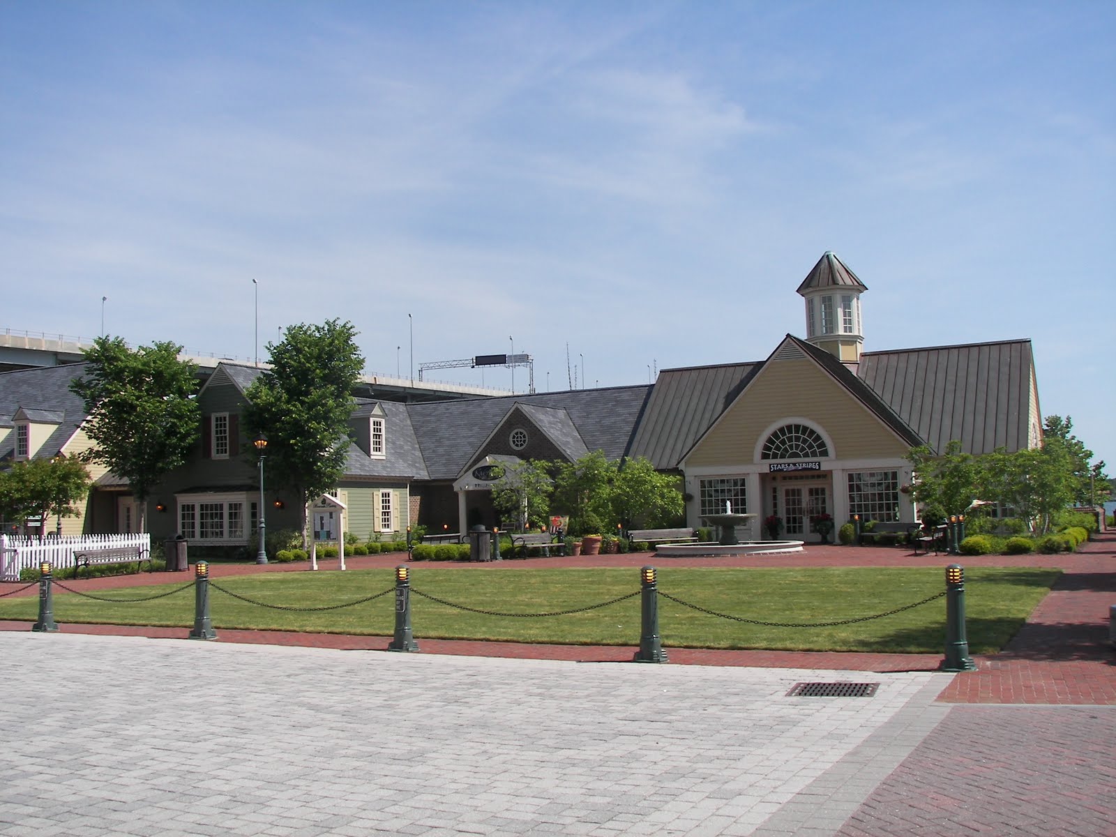
After exiting the Parkway we visited Yorktown's scenic Riverwalk. There we took the free trolley around town, had lunch at the
Riverwalk Restaurant, did some shopping, and stopped for ice cream at Ben & Jerry's.
The next feature of the day was the
George P. Coleman Memorial Bridge that carries US 17 across the York River between Yorktown and Gloucester Point. "The bridge is the largest double swing bridge in the United States, and second largest in the world." The movable span is needed to allow ship access to several military installations that are upstream.
US 17 north to Gloucester is your typical 4-lane commercialized route with lights and moderate traffic. So I decided to take VA 3. It proved to be a very nice road through farmland and small towns. Just outside Gloucester VA 3 crosses the Rappahannock River by way of the
Robert O. Norris Bridge. It "is 9,985 feet long, and provides a Mean High Water clearance of 110 feet under the center span."
Leaving VA 3 we were on US 301 for a short distance. It included a trip over the Potomac River by way of the
Governor Harry W. Nice Memorial Bridge. The bridge is 1.7 miles long with two narrow lanes, no shoulders, and a reduced speed limit. It can be lead to congestion and delays.
North of Newburg, MD we turned off US 301 and took MD 234, 236, 5, and 231 to Prince Frederick, our home for the night.
View Larger Map
Day 5 - One more Bridge to Home
We got an early start to beat the commuter traffic to Washington, DC and Annapolis. MD 2, once it split off of MD 4, turned out to be a very nice road. MD 2 put us on US 50 which took us across the Chesapeake Bay on the
Chesapeake Bay Bridge, commonly known as the Bay Bridge. It is a dual-span bridge with a length of 4.3 miles. With a maximum clearance of 186 feet it is high enough to accommodate ocean-going vessels and tall ships.
We continued on US 50 and US 301 to Middletown, DE where we picked-up DE 1 and the 'Superslab'. West of Philadelphia we stopped at the King of Prussia Mall and had lunch at
Ruby's Diner. Ruby's concept is to re-create a 40's diner. The decor is typical of the 40's and even included 3 antique motorcycles! The experience was a crowning touch to 5 great days of riding.
We finished our tour by traveling on PA 29 and the PA Turnpike. Walking in the door by mid-afternoon, we had an opportunity to reflect on the past 5 days and the unique adventures we experienced. It reminded us why we love motorcycling and the freedom of the road.
View Larger Map